Water Quality Technical Documents
River and Stream Water Quality Monitoring Plan for the Hood Canal Watershed (July 2010) This plan was developed to address the lack of a comprehensive, long-term water quality monitoring strategy for streams entering Hood Canal. Stream metrics would include chemistry, temperature, bacteria, and invertebrates. Previous studies of water quality have been too short-term or limited in the parameters measured to evaluate long-term trends.
Preliminary Quality Assurance Project Plan for Implementing the Hood Canal Stream Monitoring Strategy (July 2010) This Quality Assurance Project Plan (QAPP) describes the approach that will be taken to implement the long-term stream water quality monitoring strategy for Hood Canal. It discusses quality assurance procedures pertaining to streamflow measurement; water quality sampling and analysis; sediment, metal and priority pollutant sampling and analysis, and collection of aquatic macroinvertibrate samples in accordance with the WA State Dept. of Ecology’s Guidelines for Preparing Quality Assurance Project Plans for Environmental Studies (2004).
The implementation of a long-term water quality monitoring study of Hood Canal streams would require one or more sources for reliable funding. The purpose of this technical memorandum is to describe how water quality monitoring activities in the Hood Canal watershed are currently funded, how the data collected is being managed, and to present options for funding and data management that would better meet the needs of a long-term monitoring program.
Inventory of River and Stream Monitoring Efforts in Hood Canal (June 2010) This inventory summarized surface water quality monitoring efforts carried out by state and local groups in the Hood Canal watershed since 2000. Its purpose is to identify monitoring efforts that will best inform the development of a comprehensive, long-term, trend monitoring program for Hood Canal.
WRIA 16 Ambient Groundwater Monitoring Plan (June 2008) This plan describes an approach to monitoring well water levels and groundwater quality for naturally occurring constituents at measurable concentrations under both unimpacted and impacted conditions. It was prepared for the WRIA 16 Watershed Team to address water levels and groundwater quality. The program uses a wide array of wells to cover a large geographic area where future development is expected to occur. Groundwater monitoring has been underway since 2010 conducted by Mason PUD #1 and Jefferson PUD #1.
Webb Hill Biosolids Facility Hydrogeologic Investigation - Phase 2 (June 2008) Under Phase 2, two additional groundwater monitoring wells (MW-6 and MW-7) were installed at Webb Hill using the rotary-sonic drilling method. The new wells reinforced previous interpretations of the glacial geology under the site and water samples indicated nitrate concentrations, specific conductance and other changes to water chemistry well correlated with elevated nitrate concentrations.
Webb Hill Biosolids Facility Hydrogeologic Investigation - Phase 1 (September 2007) WRIA 16 Watershed Team hired hydrogeologists at Aspect Consulting to locate and oversee the drilling of four groundwater monitoring wells at the Bio Recycling property, conduct water sampling of the wells, and create a final report of their findings and recommendations. A technique called sonic drilling was used to provide the intact core samples needed to understand the subsurface geology. The study’s report proposed sampling well water at the regional aquifer level and surveys to determine regional aquifer flow direction. Test results indicated that nitrate was present in the groundwater beneath the Bio Recycling facility on Webb Hill.
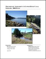
Final Preliminary Assessment of Hood Canal Streams (April 2005) This study provides baseline data for small streams draining to Hood Canal and helps identify potential problem areas for future watershed management efforts. Fourteen streams along the north and south shores of lower Hood Canal were monitored for temperature, nitrogen and fecal coliform. These included Big Bend, Alderbrook, Unnamed, Shady Beach, Twanoh, Twanoh Falls, Mulberg, Happy Hollow, Holyoke, and Deveraux on the south shore and the Tahuya River, Mission, Shoofly, and Stimson Creeks on the north shore.
WRIA 16 Surface Water Quality Monitoring Strategy (September 2003) The primary objective of this strategy is to identify long-term trends in surface water quality and flow through the monitoring of eleven baseline monitoring sites. The need to assess compliance with Washington State water quality standards is a secondary objective of the strategy. The monitoring targets conventional water quality parameters and concerns associated with increased sediment and nutrient loads. Monitoring of priority pollutant and aquatic macroinvertebrates is also discussed.
|

