
What is a WRIA?
 |
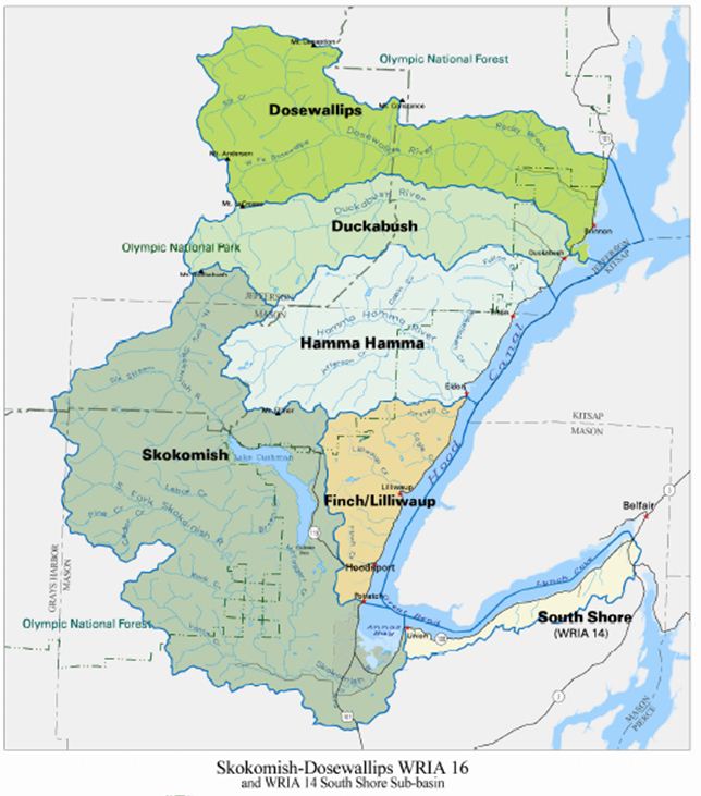
WRIA 16 is a geographical area of Washington State, one of 62 Water Resource Inventory Areas. WRIA 16 contains most of the streams and rivers flowing into Hood Canal from the west. WRIA 14b is an assemblage of smaller drainages flowing to the Canal from the South Shore. WRIA 16 has been divided into six smaller water management areas, or sub-basins, plus Hood Canal and its nearshore environment. The six sub-basins are: |
|
 |
|