Water Quantity Technical Documents
Water Demand Forecast for Future Permit-Exempt Wells in 24 Smaller Stream Basins of WRIA 16 (June 2012) This water demand analysis forecasts the potential for permit-exempt well development in small stream sub-basins along the western shore of Hood Canal in Mason and Jefferson counties. Maps and other information contained in the report are intended to complement recent stream flow data collected by the WA State Dept. of Ecology. The forecast also includes water use estimates and integrates relative ratings for habitat condition and potential stream aggradation from the 2009 River and Stream Impairment Analysis.
River and Stream Impairment Analysis (June 2009) This study examines hydrologic, habitat, and water use data and discusses the potential for stream impacts from future groundwater withdrawals. It contains a relative ranking of sub-basins and stream reaches within the WRIA based on existing salmon habitat conditions and risk of additional habitat impairment. The plan also characterizes the potential for stream aggradation within WRIA 16. A map from the study depicting habitat and water quality conditions of the South Shore, is below.
WRIA 16 Instream Flow Studies (December 2005) This study provides streamflow and fish passage data to support instream flow recommendations. Most gaging stations were operated from June 2004 to July 2005, a relatively dry period. Estimates of flow levels required to provide fish passage in certain streams are analyzed using the Instream Flow Incremental Methodology (IFIM).
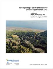
Hydrogeologic Study of the Lower Dosewallips/Brinnon Area (March 2005) This study provides a baseline of existing surface and groundwater interaction for the Brinnon area by examining the exchange of water between the Dosewallips River and local aquifers. It will serve as a tool to aid water resource management decisions related to future water supply.
|


