New Single Family Development
A common line can be used to reduce buffers and setbacks for new single-family home development or redevelopment/additions.
Existing development or property must meet code. See MCC 17.50 and 8.52.170 for details.
What is a buffer?
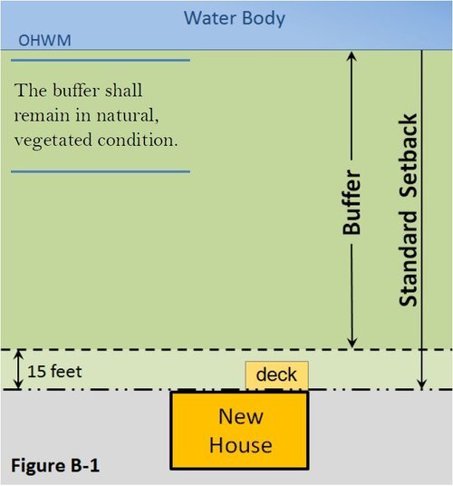
A shoreline buffer ideally should be vegetated to the greatest extent practical. When fully vegetated through mitigation and/or protected via a critical areas easement, a buffer adequately intercepts and infiltrates runoff, provides habitat for terrestrial, avian and aquatic wildlife, and reduces erosion. Development activities and vegetation removal should be avoided.
What is a setback?
A shoreline or critical area setback is the distance from a critical area (or buffer) where a solid structure shall not extend. Open decks are allowed in the setback.
How big are setbacks and buffers?
New Single-Family Residential Buffers along large lake and saltwater shorelines are typically 100-feet with a total setback from OHWM of 115-feet, though many cases result in 150-foot buffers and 165-foot structure setbacks within the Conservancy designation.


What is a Common Line?
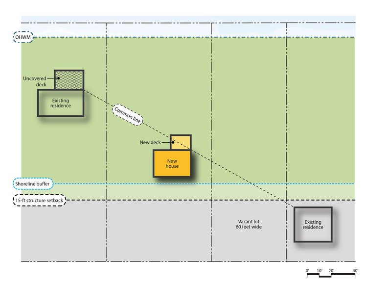
A line between nearest primary residential rooflines (either nearest or furthest roofline from subject site) where new structures can be built to (up to 35-feet of the Ordinary High Water Mark (OHWM)).
- Roofline includes covered decks
- Uncovered decks (1st or 2nd story) can be 200 SF in 35-foot or string line setback, whichever is more restrictive. See Figure B-3 and B-4 examples below.

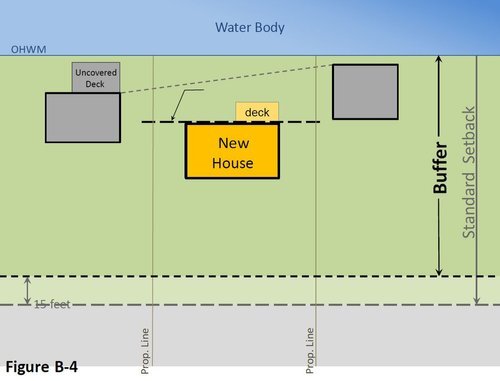
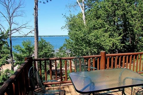
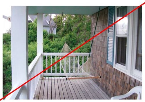
If there isn’t a residence within 150-feet of the subject lot line, a common line is drawn to the nearest property.

The 150-foot rule applies for narrow lots, where a common line can be drawn two properties over for establishment.
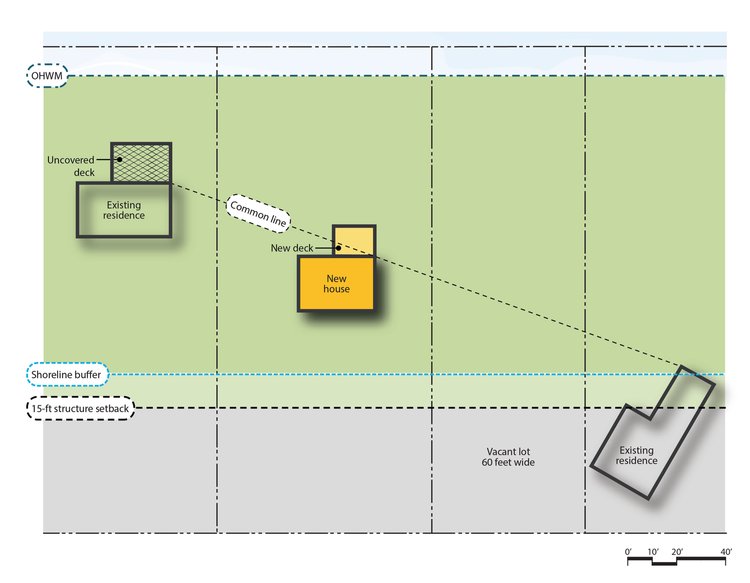
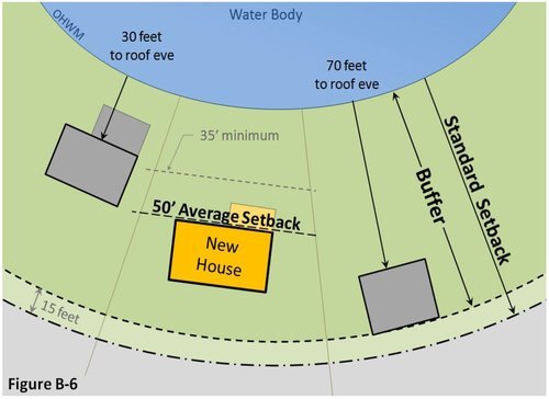
If Shoreline has a high-degree of curvature, shoreline setback is averaged between two properties, as determined by the administrator (see Figure B-6 below).
Mitigation Steps
See Example Mitigation Plan for a step-by-step example.
- Determine buffer based on where neighboring development is located (35-foot minimum from ordinary high water mark - “OHWM”).
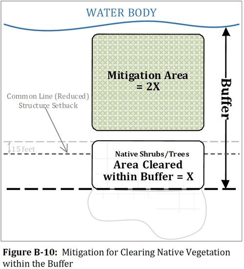
- Mitigation area is based on existing landcover to be impacted.
- Mitigation must be as close to shoreline as possible.
Scenarios
If:
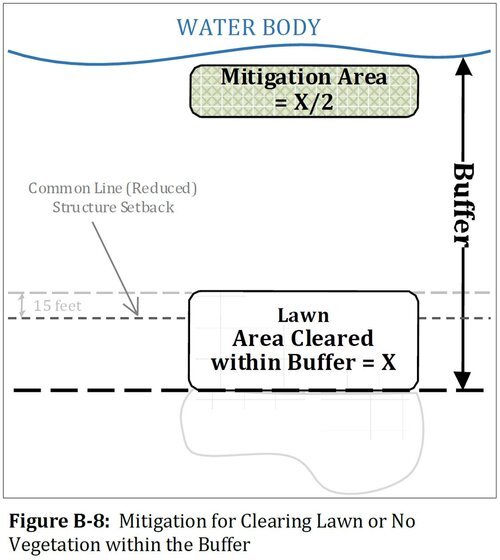
- Lawn, gravel, pavement areas cleared for structure
Mitigation = half total imapcted area (.5:1)
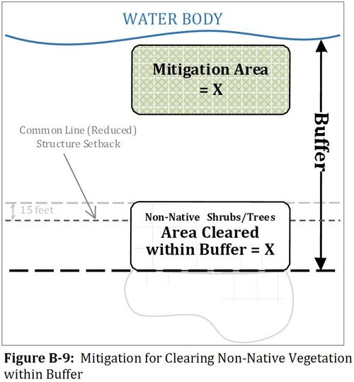
- Non-native trees and shrubs cleared
Mitigation = total impacted area (1:1).
