Geographic Information Systems - Available Development Area Maps Panels
The GIS Department has several standard maps for sale. To purchase a map, please contact the GIS Department at 360-427-9670 ext 515, or come by the office, located at 100 W Public Works DR in Shelton. Prices do not include tax or shipping and handling. |
|
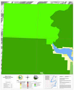
| 41” x 50” portrait Map panel 1 covers Township 24 North, Ranges 5 and 6 West and Township 23 North Ranges 5 and 6 West. The majority of this map covers National Park and National Forest lands and portions of Lake Cushman. |
|
$25.00 | |
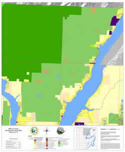
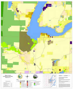
| 41” x 50” portrait Map panel 2 covers Township 24 North, Ranges 3 and 4 West and Township 23 North Ranges 3 and 4 West. This map includes portions of the Hood Canal, part of the Tahuya Peninsula, Lilliwaup and Dewatto. |
|
$25.00 | |
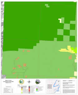
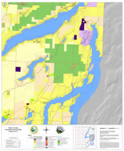
| 41” x 50” portrait Map panel 3 covers Township 24 North, Ranges 1 and 2 West and Township 23 North Ranges 1 and 2 West. This map includes the area surrounding Belfair and part of the Tahuya Peninsula. |
|
$25.00 | |
| 41” x 50” portrait Map panel 4 covers Township 22 North, Ranges 5 and 6 West and Township 21 North Ranges 5 and 6 West. This map covers portions of the National Park, the Beeville Loop area, and the western end of the Skokomish Valley. |
|
$25.00 | |
| 41” x 50” portrait Map panel 5 covers Township 22 North, Ranges 3 and 4 West and Township 21 North Ranges 3 and 4 West. This map covers southern Lake Cushman, Hoodsport, Union, Alderbrook and Tahuya. |
|
$25.00 | |
41” x 50” portrait |
|
$25.00 | |
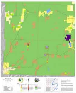
| 41” x 50” portrait Map panel 7 covers Township 20 North, Ranges 5 and 6 West and Township 19 North Ranges 5 and 6 West. This map includes Matlock, Dayton, Schafer Park, Lake Nahwatzel, Star Lake, and Lost Lake. |
|
$25.00 | |
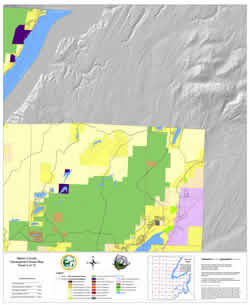
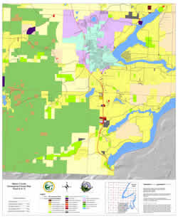
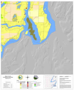
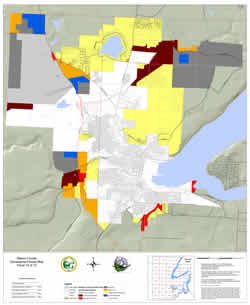
| 41” x 50” portrait Map panel 8 covers Township 20 North, Ranges 3 and 4 West and Township 19 North Ranges 3 and 4 West. This map includes Taylor Town, Kamilche, Shorecrest, and the area surrounding Shelton. Panel 8 was updated to include interim zoning adopted on 6/2/2009 for parcels in the county that used to be within the Shelton UGA boundary. |
|
$25.00 | |
| 41” x 50” portrait Map panel 9 covers Township 20 North, Ranges 1 and 2 West and Township 19 North Ranges 1 and 2 West. This map includes central and southern Harstine Island, Arcadia Point, Timberlakes, and Phillips Lake. |
|
$25.00 | |
41” x 50” portrait |
|
$25.00 | |